
35TH INTERNATIONAL GEOLOGICAL CONGRESS
27 AUGUST - 4 SEPTEMBER 2016 | CAPE TOWN, SOUTH AFRICA
 Home
Home Field trips
  Sponsorship & expo
  Registration
 Tours
Tours  Promotion
 Sponsors


35 IGC SAGPGF
 Limited")


Partners


35TH INTERNATIONAL GEOLOGICAL CONGRESS
27 AUGUST - 4 SEPTEMBER 2016 | CAPE TOWN, SOUTH AFRICA
My IGC

Working with Interoperable Data
Description
This one-day workshop is presented by the IUGS Commission for Geoscience Information (CGI). The workshop will introduce geoscience data providers and users to working with interoperable web services using Open Geospatial Consortium (OGC) and CGI data standards. Presenters will demonstrate the use of international standards such as GeoSciML, EarthResourceML and standard geoscience vocabularies, for interoperable data transfer over the internet. The workshop will show how to construct a standard Web Map Service and Web Feature Service from your geological data, and will demonstrate online web portals and desktop tools for consuming geological web services.
Delegate workshop costs are reduced for this offering thanks to CGI sponsorship!
Date
To be confirmed
Presenters
Ollie Raymond, Mark Rattenbury, Jouni Vuollo, Carlo Cipolloni, James Passmore, Tim Duffy
Price:
R800 (reg delegates) & R1200 (non-reg delegates)
Registration Details
To book and pay, please use your existing registration log in (if you are already registered). New delegates can book using the registration form on the website (create your profile and register for the conference and then book your additional workshop)
Programme
Introduction to Interoperability
- Who are CGI and OGC
- Web Services, simple and complex
Introduction to CGI and OGC geoscience data standards
- GeoSciML v4
- EarthResourceML
- Geoscience Vocabularies
Delivering Interoperable Data through Web Services
- How to build a web service – from database to OneGeology WWW
- Examples of existing geoscience web services
Consuming Geoscience Web Services
- Examples of web portals and desktop applications
Presenter Biographies
 |
Ollie Raymond has been compiling and managing geological maps and databases at Geoscience Australia (GA) for over 20 years, and is now custodian of GA’s geological web services. Ollie has been Chair of the CGI/OGC GeoSciML Standards Working Group since 2008, and is a member of the CGI Geoscience Terminology Working Group. He was part of the Australian team which designed the mineral deposits data standard now known as EarthResourceML. Ollie is also a member of the CGI Council, the Australia/NZ Government Geoscience Information Committee, and is the Australian technical delegate for OneGeology. |
 |
Mark Rattenbury is a Research Leader and geologist with GNS Science, New Zealand specialising in regional geology, geological mapping and dissemination of geoscience information. Since 2008, Mark has been involved with international geoscience information initiatives through OneGeology and IUGS CGI working groups. Mark is the current Chair of the CGI Geoscience Terminology Working Group, is a member of the Australia/NZ Government Geoscience Information Committee, and is the New Zealand delegate for OneGeology. |
 |
Jouni Vuollo has 20 years experience in geological data management at Oulu University and the Geological Survey of Finland (GTK). He is currently Head of Unit (Regional Geology and Interpretation) at GTK. Jouni has been involved in the GeoSciML Standards Working Group since 2008, as a GTK delegate. In 2010, he became a member of the Thematic Working Group 'Geology & Mineral Resources' for the development of the European Union’s INSPIRE data specifications. Jouni joined the CGI EarthResourceML Working Group in 2010 and has been Chair of the working group since 2012. |
 |
Carlo Cipolloni is a member of the EU INSPIRE Maintenance and Implementation Group where he is work program leader for Validation and Conformity Testing. He is the manager for ISPRA for projects such as the INSPIRE Test Data Model, eENVplus, LIFE+IMAGINE, LINKVIT, and is the Italian representative on the Board of the EU Joint Research Centre. Carlo is a member of CGI/OGC GeoSciML Standards Working Group, is the Italian delegate for OneGeology, and has been involved in many other IT and standards-related projects (i.e. PanGeo, OneGeology-Europe, Geoportal of the Geological Survey of Italy). |
 |
James Passmore is a member of the Informatics team at the British Geological Survey (BGS), where he specializes in all aspects of the delivery of Spatial Data Infrastructure. He has been involved in numerous projects for the sharing of data through web services, such as eEarth, OneGeology, Minerals4EU, PanGeo, and EarthServer. James is the editor of the OneGeology WMS and WCS cookbooks. He is currently working on the development of the EPOS research infrastructure and as the editor of the INSPIRE technical guidance for the delivery of download services using WCS. |
 |
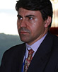
Tim Duffy is the British Geological Survey (BGS) Head of Geoscience Interoperability and has been responsible for leading data interoperability and web services projects for more than ten years. He is project leader for the OneGeology initiative ( www.onegeology.org) and has been responsible for leading the design and implementation of web services in the global community of Geological Surveys since 2007. He is also a leading contributor to the design and implementation of the European level INSPIRE Spatial Data Infrastructure and sits on numerous INSPIRE committees at the European and Member State level. He is also a member of the OGC/CGI GeoSciML focused working groups and has been working in the informatics area of exchanging GIS data on the WWW for 20 years. |
 Conference Programme
  Field trips
  Sponsorship & expo
  Volunteer
  GeoHost
  Registration
 Tours
Tours  Promotion
  Publications


