
35TH INTERNATIONAL GEOLOGICAL CONGRESS
27 AUGUST - 4 SEPTEMBER 2016 | CAPE TOWN, SOUTH AFRICA
 Home
Home Field trips
  Sponsorship & expo
  Registration
 Tours
Tours  Promotion
 Sponsors


35 IGC SAGPGF
 Limited")


Partners


35TH INTERNATIONAL GEOLOGICAL CONGRESS
27 AUGUST - 4 SEPTEMBER 2016 | CAPE TOWN, SOUTH AFRICA
My IGC

Remote Sensing for Mineral Exploration
Description
This course will demonstrate the applicability of remote sensing data in mineral exploration, its added value as well as the limitations. The workshop will equip the participants with concrete, simple workflows to generate targets from remote sensing data.
Date
Sun 28th Aug
Presenters
Dr. Rob Hewson and Chris Hecker
Programme
This short course gives an overview of what remote sensing can do for the exploration part of the minerals value chain. It takes the participants through the entire workflow from searching appropriate images at the data providers, to processing the images and generating follow-up targets for ground investigations. The focus is on affordable data as well as free software solutions. This allows the participants to practice with real data during the course, as well as continue working with remote sensing data at their offices after the course has finished.
The material will cover different systems from different parts of the world, such as epithermal gold, porphyry copper, Cu-Skarn and VMS. The course will concentrate on the use and applicability of multi-spectral ASTER data in exploring for these mineral systems. The course also contains elements of other multi-spectral data (e.g. Landsat, Sentinel2) for mineral mapping and RADAR data (SRTM and Sentinel1) for interpretation of major lineaments. Additionally, the use of WorldView3 data and of airborne hyperspectral/thermal infrared data can be demonstrated for more detailed (follow-up) studies, depending on the interest of participants.
At the end of the course, the participants will understand the applicability of remote sensing data in mineral exploration, its added value, as well as the limitations. They will also be equipped with concrete, simple workflows to generate targets from remote sensing data.
Registration Details
To book and pay, please use your existing registration log in (if you are already registered). New delegates can book using the registration form on the website (create your profile and register for the conference and then book your additional workshop).
Participants should bring their own laptop to work on some the practical examples
Presenter Biographies
|
Dr. Rob Hewson graduated in BSc(Hons) geophysics at University of Melbourne, Australia, in 1981 and worked within Shell until 1989. He subsequently undertook a MSc study on in-seam seismic geophysics at Macquarie University followed by a PhD at the University of NSW on geological remote sensing. He was employed as a remote sensing geoscientist from 1998 to 2010 within Australia’s CSIRO Exploration and Mining Division, focusing on mineral spectroscopy and geological case study development of hyperspectral HyMap, multi-spectral ASTER, and integrated airborne geophysics data sets. Between 2011-2016 he consulted for industry and undertook studies as a research fellow and casual lecturer within the School of Mathematical & Geospatial Sciences at RMIT University, Melbourne. Consulting projects have included mapping for the Geological Survey of New South Wales using day / night time ASTER, airborne geophysics and field sample spectroscopy; and more recently mapping for Tasmania’s MRT using AIRSAR and TOPSAR airborne radar. He has recently been appointed as Assistant Professor of Geological Remote Sensing at University of Twente (ITC). |
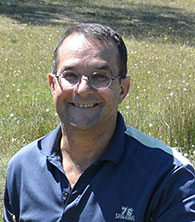 Dr. Rob Hewson Dr. Rob Hewson |
|
Dr. Chris Hecker is an Assistant Professor in Geological Remote Sensing with the Faculty of Geo-Information Science and Earth Observation (ITC), University of Twente, The Netherlands. His specialty is thermal infrared remote sensing to study mineralogy of hydrothermal and geothermal alteration systems to facilitate the exploration of mineral deposits and renewable energy sources. http://www.itc.nl/resumes/hecker |
|
 Dr. Chris Hecker
  Conference Programme
  Field trips
  Sponsorship & expo
  Volunteer
  GeoHost
  Registration
 Tours
Tours  Promotion
  Publications


